


ADAMS 01, Madison County, Indiana
About
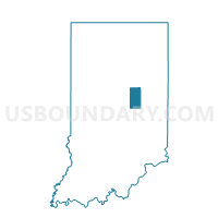
Outline

Summary
| Unique Area Identifier | 579067 |
| Name | ADAMS 01 |
| County | Madison County |
| State | Indiana |
| Area (square miles) | 20.51 |
| Land Area (square miles) | 20.49 |
| Water Area (square miles) | 0.01 |
| % of Land Area | 99.93 |
| % of Water Area | 0.07 |
| Latitude of the Internal Point | 40.01691050 |
| Longtitude of the Internal Point | -85.62443950 |
Maps


Graphs
Select a template below for downloading or customizing gragh for ADAMS 01, Madison County, Indiana


Neighbors
Neighoring Voting District (by Name) Neighboring Voting District on the Map
- ADAMS - ANDERSON 3, Madison County, IN
- ADAMS 02, Madison County, IN
- ANDERSON CITY 03-08, Madison County, IN
- FALL CREEK 03, Henry County, IN
- FALL CREEK 04, Henry County, IN
- FALL CREEK 6, Madison County, IN
- FALL CREEK 8, Madison County, IN
- HARRISON, Henry County, IN
- UNION 07, Madison County, IN
Top 10 Neighboring County Subdivision (by Population) Neighboring County Subdivision on the Map
- Anderson township, Madison County, IN (56,436)
- Fall Creek township, Madison County, IN (14,695)
- Union township, Madison County, IN (8,898)
- Fall Creek township, Henry County, IN (4,612)
- Adams township, Madison County, IN (3,892)
- Harrison township, Henry County, IN (1,352)
Top 10 Neighboring Place (by Population) Neighboring Place on the Map
Top 10 Neighboring Unified School District (by Population) Neighboring Unified School District on the Map
- Anderson Community School Corporation, IN (71,503)
- South Madison Community School Corporation, IN (26,125)
- Shenandoah School Corporation, IN (7,470)
Top 10 Neighboring State Legislative District Lower Chamber (by Population) Neighboring State Legislative District Lower Chamber on the Map
Top 10 Neighboring State Legislative District Upper Chamber (by Population) Neighboring State Legislative District Upper Chamber on the Map
Top 10 Neighboring 111th Congressional District (by Population) Neighboring 111th Congressional District on the Map
Top 10 Neighboring Census Tract (by Population) Neighboring Census Tract on the Map
- Census Tract 112, Madison County, IN (6,247)
- Census Tract 18, Madison County, IN (4,808)
- Census Tract 9757, Henry County, IN (4,687)
- Census Tract 115.01, Madison County, IN (4,640)
- Census Tract 9758, Henry County, IN (4,589)
- Census Tract 115.02, Madison County, IN (4,065)
- Census Tract 114, Madison County, IN (3,892)
Top 10 Neighboring 5-Digit ZIP Code Tabulation Area (by Population) Neighboring 5-Digit ZIP Code Tabulation Area on the Map
- 46013, IN (17,876)
- 46064, IN (17,148)
- 46017, IN (6,025)
- 47356, IN (5,781)
- 46056, IN (2,246)
- 47384, IN (2,000)